New York City, New York — Residents across the Northeast are expected to get a brief break from the latest stretch of summer heat this weekend, but meteorologists warn that cooler temperatures will not stick around for long.
A cold front moving through the eastern United States is expected to temporarily lower temperatures and humidity levels before another round of midsummer heat builds across much of the region next week.
Cold Front Brings Temporary Relief
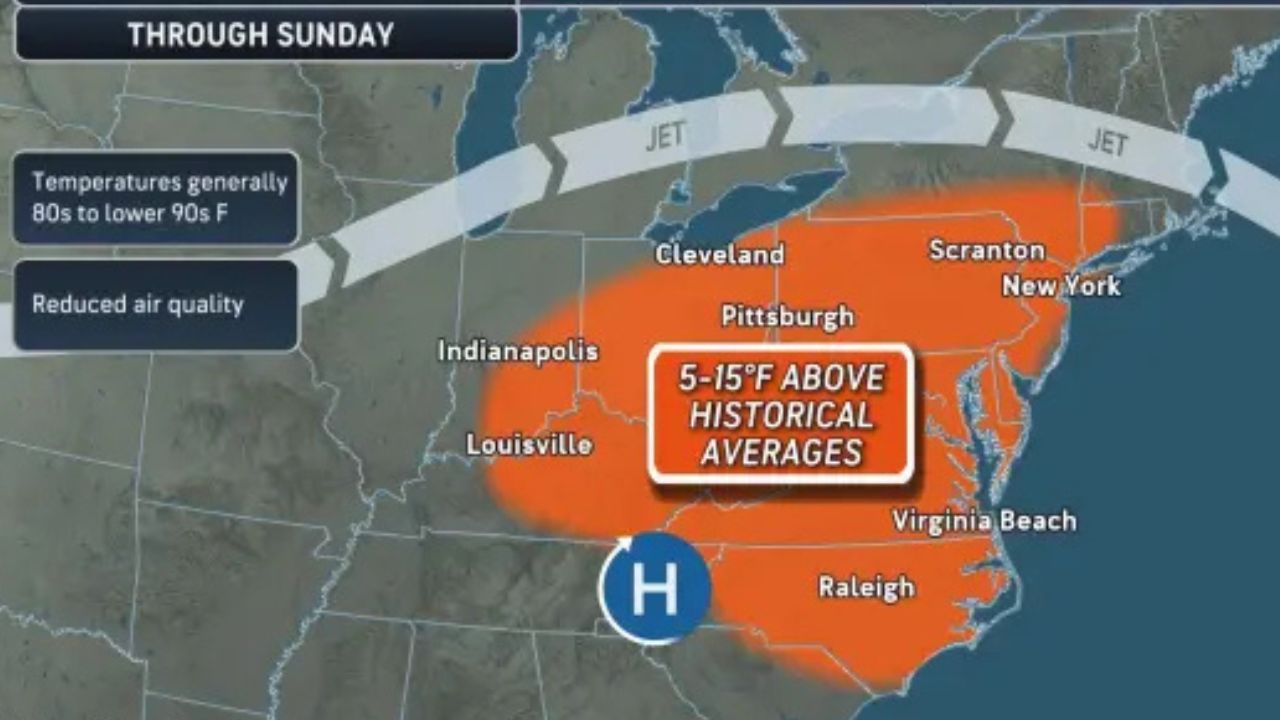
Through Saturday, many locations across the interior Mid-Atlantic are expected to experience afternoon temperatures in the mid-90s, while much of the Midwest and interior Northeast remain in the 80s.
The approaching cold front will gradually move through the region from Saturday into Monday, bringing a noticeable change in weather conditions.
Forecasters say the most significant cooling will occur across the Northeast, where temperatures could fall by 10 to 20 degrees compared to recent highs.
While the drop will be noticeable, meteorologists note it will not be as dramatic as some of the sharp temperature swings experienced earlier this summer.
Thunderstorms Could Turn Severe
The arrival of the cold front may also trigger rounds of showers and thunderstorms across parts of the Northeast and Mid-Atlantic. Weather experts warn that some storms developing during the late afternoon and evening hours on Saturday and Sunday could become severe.
Potential hazards include damaging wind gusts, hail and torrential downpours.
For some communities, the rainfall could provide the first measurable precipitation in more than a week, offering limited relief from increasingly dry conditions.
However, localized flooding remains possible in areas that receive repeated rounds of heavy rain.
Heat and Humidity Set to Return Quickly
Despite the brief cooldown, forecasters expect warmer weather to return almost immediately next week.
“The jet stream pattern will shift quickly next week. Unlike previous episodes that sustained cooler weather for several days, this dip in the jet stream will move through in only 24-36 hours,” a meteorologist said.
“It will be followed by a pronounced northward bulge, allowing much warmer air to return.”
Monday is expected to be the coolest day of the upcoming week for many locations. After that, temperatures are forecast to climb steadily once again.
Midsummer Conditions Expected by Midweek
By Tuesday and Wednesday, much of the Northeast is expected to see highs return to the 80s.
From Thursday through next Saturday, temperatures could range from the 80s into the mid-90s, depending on local cloud cover and weather conditions.
Humidity levels are also expected to increase significantly.
Unlike the relatively moderate humidity experienced recently, next week’s air mass may feel noticeably more oppressive and uncomfortable for many residents.
The combination of heat and humidity could make outdoor activities more challenging, particularly during the hottest parts of the day.
Drought Concerns Continue Across the Region
While isolated storms are expected this weekend, forecasters say dry weather will likely dominate much of next week across the Northeast.
As a result, existing drought conditions may continue to worsen in some locations.
Meanwhile, parts of the Midwest could experience even hotter temperatures, with highs climbing into the upper 90s by the middle of next week.
Repeated thunderstorms across portions of the Mississippi and Ohio valleys may increase the risk of flash flooding in those areas.
Meteorologists are also monitoring the possibility of tropical moisture moving northward from the Gulf region later next week and into the third week of the month.
If that moisture develops and reaches the Northeast, it could bring both beneficial drought-relieving rainfall and disruptive torrential downpours to portions of the eastern United States.
How are you preparing for another round of heat and humidity? Share your thoughts and local weather conditions in the comments below.