Bismarck, North Dakota — A widespread severe weather outbreak is expected to impact large portions of the Central United States this week, bringing the threat of baseball-sized hail, tornadoes, damaging winds and flash flooding from the Northern Plains to the Southern Plains.
Forecasters say the dangerous weather pattern follows a powerful hailstorm that slammed the Denver metro area Monday and could continue producing significant impacts across multiple states through the remainder of the week.
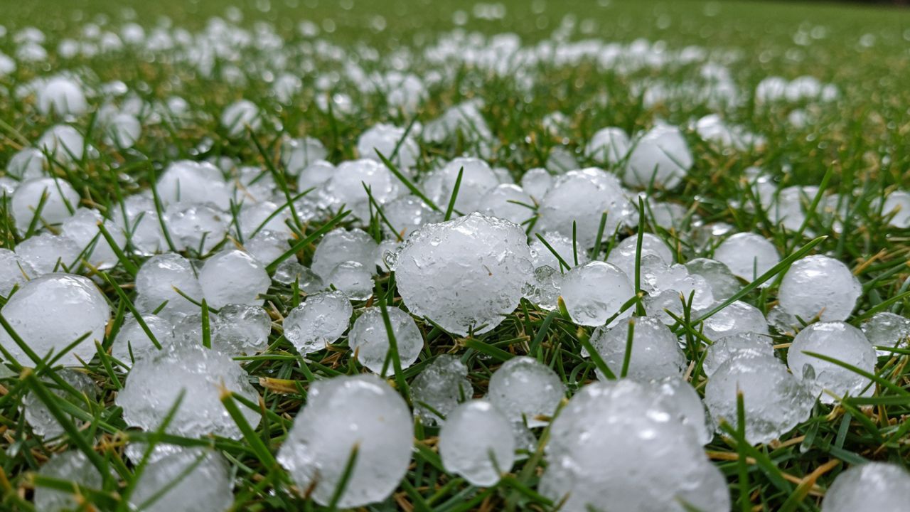
Denver Hit by Powerful Hailstorm
The severe weather pattern first made headlines Monday afternoon when an intense thunderstorm rapidly developed over Denver. The storm erupted shortly after 1 p.m., unleashing large hail across the metropolitan area and creating hazardous travel conditions.
Reports indicated that golf ball-sized hail fell in downtown Denver, while motorists sought shelter beneath highway overpasses as the storm intensified.
The severe weather also disrupted air travel.
Officials temporarily issued a Ground Stop at Denver International Airport, causing delays for hundreds of arriving and departing flights.
The storm served as an early sign of the larger weather system now spreading across the Plains.
Severe Weather Threat Expands Across the Plains
Meteorologists expect severe thunderstorms to redevelop Tuesday afternoon and evening across a broad stretch of the Great Plains.
The National Oceanic and Atmospheric Administration’s Storm Prediction Center has placed parts of North Dakota, South Dakota, eastern Wyoming and northwestern Nebraska under a Level 2 out of 5 severe weather risk.
Cities including Bismarck, North Dakota, and Rapid City, South Dakota, are among the areas expected to face the highest threat.
Forecasters warn that storms could produce baseball-sized hail, destructive wind gusts and isolated tornadoes.
Weather experts say any supercell thunderstorms that form will have the potential to generate rotating storms capable of producing tornadoes.
Heat Wave Alert: New York, Philadelphia and D.C. Set to Swelter Before Temperatures Crash
Flash Flood Threat Increasing
In addition to severe thunderstorms, concerns are growing over significant rainfall and flash flooding.
Parts of North Dakota are currently under a Level 2 out of 4 flash flood threat, where repeated rounds of storms may produce excessive rainfall over already saturated areas.
Meanwhile, eastern New Mexico and the Texas Panhandle are also facing elevated flood risks as multiple storm systems move through the region.
Slow-moving thunderstorms are expected to dump heavy rainfall in localized areas, increasing the potential for rapid flooding.
Meteorologists warn that flash flooding can occur quickly, especially in low-lying areas, near creeks and streams, and in urban locations with poor drainage.
Rain May Bring Drought Relief
While the storms pose serious hazards, forecasters note that the rainfall may also provide some benefits.
Heavy precipitation is expected to help reduce Extreme Drought conditions affecting portions of the Texas Panhandle, Oklahoma Panhandle and parts of the Southern Plains.
Several regions have experienced prolonged dry conditions, and widespread rainfall could offer temporary relief to farmers, ranchers and local water supplies.
However, experts caution that excessive rainfall falling in a short period can still create dangerous flooding despite the drought conditions.
Flood Risk Expected to Reach Midwest
The ongoing weather pattern is being fueled by a dip in the jet stream combined with 90-degree temperatures and a steady flow of moisture from the Gulf.
This combination is expected to continue generating strong thunderstorms throughout the week. Forecasters say the flood threat will not remain confined to the Plains.
Beginning Wednesday, the risk for heavy rain and flash flooding is expected to expand into parts of the Upper Midwest, potentially affecting additional communities already monitoring the severe weather outbreak.
Residents across impacted areas are being urged to stay alert for weather warnings and be prepared for rapidly changing conditions as this active storm pattern continues.
Are you experiencing severe weather in your area? Share your conditions and thoughts respectfully in the comments below.