Chicago, Illinois — After much-needed rainfall moved through parts of the Chicago area, attention is now shifting to a potentially dangerous stretch of weather that could bring near-100-degree heat index values followed by multiple rounds of strong to severe thunderstorms.
Forecasters are warning residents to prepare for oppressive humidity, dangerous heat and the possibility of severe weather during the middle of the week.
Warm and Muggy Conditions Continue Overnight
Rain and thunderstorms provided relief to some communities Monday, with downpours occurring at times across the region.
While severe weather was largely avoided during the initial round of rain, forecasters say the humid air mass responsible for the storms remains firmly in place.
Overnight temperatures are expected to remain unusually warm, with lows hovering around 70 degrees and muggy conditions continuing through the night.
A few isolated showers and rumbles of thunder may linger into early Tuesday morning before conditions temporarily improve.
Tuesday Brings Building Heat and Humidity
Much of Tuesday is expected to remain dry, although the atmosphere will become increasingly uncomfortable as temperatures climb. Afternoon highs are forecast to reach well into the 80s, while elevated humidity levels push heat index values into the lower 90s.
A southwest wind between 10 and 20 mph may provide limited relief, but forecasters say conditions will still feel hot and sticky for most of the day.
Cloud cover is expected to dominate at times, though occasional sunshine could help fuel additional instability ahead of the next weather system.
By late Tuesday, a few thunderstorms may begin approaching the Chicago area.
Wednesday Could Feel Like 100 Degrees
Weather experts are calling Wednesday the hottest and most uncomfortable day of the week. Actual air temperatures are expected to climb into the 90s, while extremely high humidity levels could push the heat index close to 100 degrees.
The combination of heat and moisture may create dangerous conditions for anyone spending extended periods outdoors.
Residents are encouraged to stay hydrated, limit strenuous outdoor activity and monitor weather updates throughout the day. In addition to the heat, forecasters are tracking the potential for two separate rounds of thunderstorms.
The first round could develop during the early morning hours before quickly moving out of the area.
A second round later in the day may be much stronger.
Severe Storm Threat Increases Midweek
Forecasters say Wednesday afternoon and evening storms could become severe. Strong winds, heavy rainfall and dangerous lightning are possible if storms intensify.
However, Thursday currently appears to present the greatest severe weather threat of the week. Weather models indicate that a large storm complex could move into the region during the afternoon and evening hours.
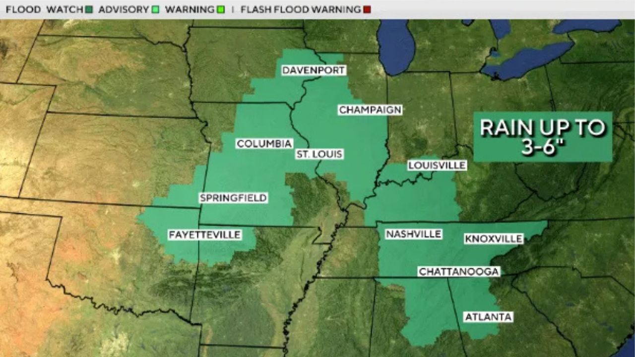
Life-Threatening Flood Threat Expands Across U.S. as Storms Target Millions From Midwest to South
Forecasters warn that all severe weather hazards may be possible, including:
- Damaging wind gusts
- Large hail
- Tornadoes
Meteorologists caution that the exact timing and severity of Thursday’s threat may still change as new forecast data becomes available.
Cooler Weather Returns for the Weekend
After several days of heat and storm chances, conditions are expected to improve heading into the weekend.
Friday and Saturday will remain warm, with temperatures staying in the 80s, but humidity levels should gradually decrease. A cold front could trigger a few showers Saturday night before ushering in significantly cooler air.
By Sunday, highs are expected to fall back into the 70s, with lower humidity and more comfortable conditions. Forecasters are also predicting sunshine and temperatures in the lower 70s by Monday, while overnight lows may dip into the 50s.
The upcoming pattern offers a welcome break after a potentially dangerous stretch of heat and severe weather.
Are you preparing for the extreme heat and storm threats expected this week? Share your thoughts and weather plans in the comments below.