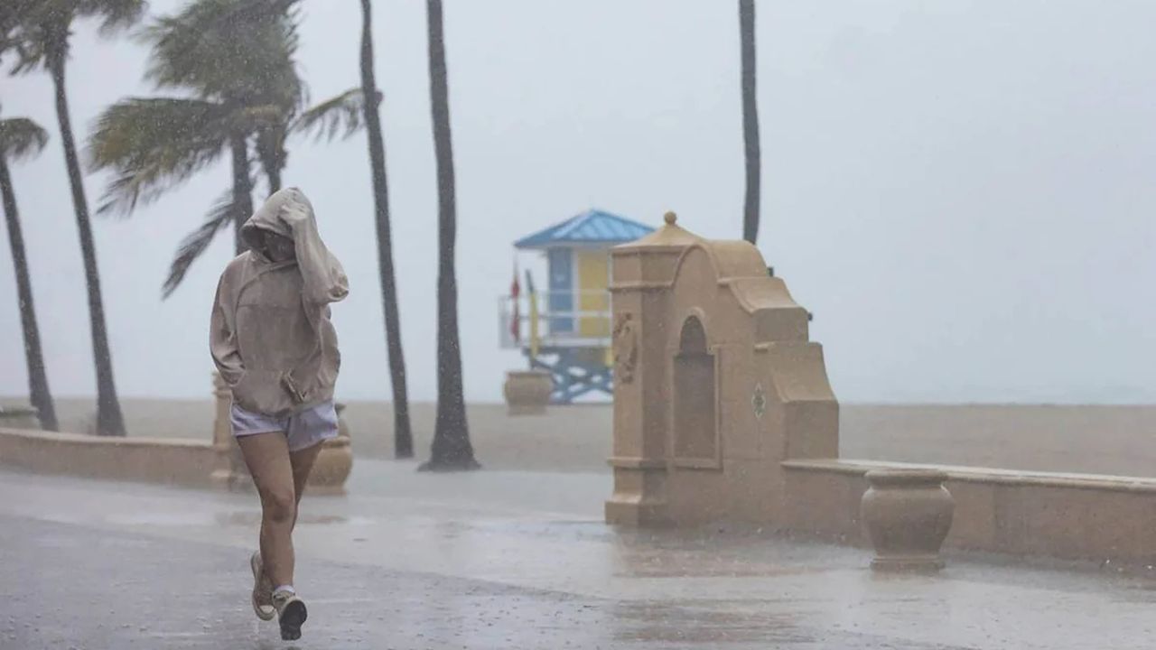
Miami, Florida — South Florida is facing another day of unsettled weather as deep tropical moisture combines with warm temperatures and an approaching cold front, increasing the risk of flash flooding across the region.
Forecasters are warning residents in Miami and surrounding communities to remain alert for heavy rainfall that could lead to localized flooding, particularly in urban and low-lying areas.
Tropical Moisture Fuels Flooding Concerns
Meteorologists say a significant plume of tropical moisture continues to move across the Sunshine State, creating favorable conditions for widespread showers and thunderstorms.
The weather pattern is being enhanced by a southward-moving cold front, which is interacting with the moisture-rich air mass over South Florida.
As a result, periods of heavy rainfall are expected throughout the day, raising concerns about flooding in areas that are prone to water accumulation.
The combination of abundant moisture and slow-moving storms could allow heavy rain to fall repeatedly over the same locations.
Miami Among Areas Facing Flash Flood Threat
A Level 1 out of 4 flash flood threat has been issued for much of South Florida, including communities along the Treasure Coast and Gold Coast.
Cities included in the risk area include West Palm Beach, Fort Lauderdale and Miami.
While the flood threat is categorized as relatively low, forecasters caution that even minor flooding can create hazardous travel conditions and impact neighborhoods with poor drainage systems.
Urban areas are especially vulnerable when intense rainfall falls within a short period of time.
Some Areas Could Receive Up to 5 Inches of Rain
Weather models suggest many locations across South Florida could receive approximately 2 inches of rainfall during this weather event.
However, forecasters warn that localized rainfall amounts may be significantly higher where thunderstorms repeatedly develop.
In some communities, rainfall totals could approach 5 inches, particularly if storm cells remain nearly stationary or continue tracking over the same areas.
Such rainfall amounts could quickly overwhelm drainage systems and lead to flooded roadways, standing water and temporary disruptions to daily activities.
Residents are encouraged to avoid driving through flooded streets and monitor local weather updates throughout the day.
Warm Temperatures Continue Across South Florida
Despite the increased rain chances, temperatures across the region are expected to remain well above average. In Miami, daytime highs are forecast to reach the mid-80s, creating warm and humid conditions throughout much of the day.
Even after sunset, little relief is expected from the heat.
Forecasters predict overnight temperatures will only fall into the mid-70s, resulting in another warm and muggy night across South Florida.
The persistent warmth combined with high moisture levels will continue creating an environment favorable for additional showers and thunderstorms.
Residents Urged to Stay Weather Aware
Officials are encouraging residents to remain weather aware as conditions evolve throughout the day.
While widespread severe weather is not currently expected, localized flooding remains the primary concern due to the possibility of intense rainfall rates and repeated storm activity.
Drivers, commuters and residents in flood-prone neighborhoods are advised to monitor forecasts closely and be prepared for rapidly changing conditions.
With tropical moisture expected to linger across the region, additional rounds of rain may continue to impact South Florida in the coming days.
Have you experienced flooding or heavy rain in your area recently? Share your thoughts and weather conditions respectfully in the comments below.